

ADOBE CREEK
The final Preliminary Engineering Report has been completed and is available on the SRWG Resources page.
In spring of 2021, a portion of the Sun River is captured by Adobe Creek. Multiple channels are visible, including the Sun River, Adobe Creek, and another channel - possibly an old channel of Adobe or the Sun. This “capture” results in higher than normal flows in Adobe Creek. In January of 2022, an ice jam caused the river to avulse again in this same area, causing flooding of nearby fields and putting residences at risk. Although we recognize that Sun River has historically been highly mobile in this reach, as described in our 2020 Channel Migration Report (available here) SRWG, Cascade Conservation District, and others are working to find a way to reduce the impacts to farms, residences, and infrastructure affected by this current river movement.
All photos and video are courtesy of Montana Map Works. For more information or for more photos/video, contact SRWG.
An emergency landowner meeting was held June 8, 2021 at Parker Farms.
For more information or to be added to the Adobe Creek mailing list, contact Tracy@sunriverwatershed.org or Tenlee@cascadecd.com. We will provide updates on this situation and about upcoming meetings as frequently as possible.
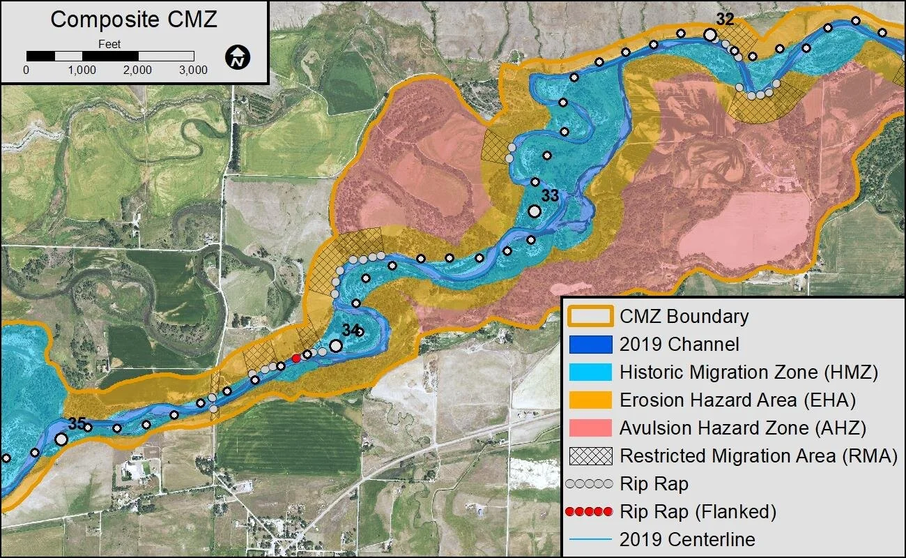
The Sun River Channel Migration Zone Report is now complete.
The Sun River Channel Migration Zone Report (CMZ) was updated in 2021 to include CMZ maps of Elk Creek and more in-depth analysis and recommendations for the Adobe Creek avulsion site. This report will be an important resource for SRWG and other stakeholders as we work towards projects at the Adobe Creek avulsion and other areas along the river.